Charity Valley West to Charity Valley East/Burnside Lake Junction
6 miles round trip-moderate


Do not make the mistake that you can find the Charity Valley West trailhead with just the general knowledge of where it is located on Blue Lakes Road. I have already made that mistake for you. My first attempt had me in the general area for about an hour, and despite checking a number of turnouts and back roads, I missed the trailhead by only a few hundred feet. However, the following day, I went back better prepared. Having looked at a satellite image of the area, identifying the trail, and seeing where the trailhead met the road, I was much more confident I could find it. Still, I took the precaution of determining that it was down Blue Lakes Road 6.2 miles from the junction with Hwy 88 (at GPS coordinates 38.6721N, -119.91769W). These photos show your parking area on the west side of the road and the beginning or the trail (next to the rock pile) on the east side.

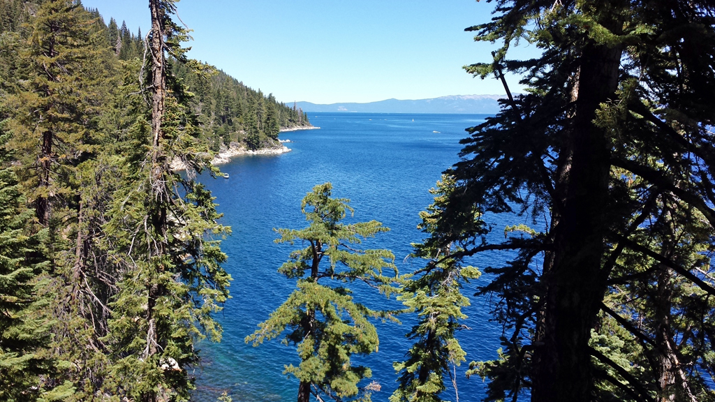
The trail takes you along Charity Valley keeping you up on the valley walls through a high-chaparral area, open and spotted with sage and other brush with occasional rock outcroppings and patches of trees–all under the view of Markleeville Peak. When preparing for this hike, I had expected this sort of terrain for much of the trip, however, after about half an hour the trail takes you in along Charity Valley Creek and slips back into trees that that provide welcome shade. Both creek and trees will be with you for a significant portion of the remainder of the trip.
The trail largely follows the creek, a fact which can help you keep on track in the few areas where the trail becomes difficult to follow. On my outing, close to an hour in, the trail led to a large rock outcropping from which I was unable to determine what was trail and what was not. Having some idea of the location of the trail junction from my Charity Valley East trip (Charity Valley East to Burnside Lake), I started up the rocks hoping to find the trail again. Fortunately, despite choosing incorrectly, it did not take long to come to a vantage from which I could see what looked like a trail below. Even so, I chose to do some exploring of the outcropping as the area was beautiful and my kids love clamoring over areas like this. Once I had my fill, I started working down toward the area where I thought I had seen the trail and found it with little difficulty. Following the trail backwards to see where I had gone wrong, I found that other travellers had done a fairly good job of leaving rocks-on-rocks (RoR) markers. My original mistake had me miss seeing the first RoR marker by ten or fifteen feet after which they become easy to follow and lead down the outcropping toward the creek. I added a few more RoR markers for those like me who would otherwise get off track very early in the process. Heading down the outcropping, you will hear falling water and can find a nice, shallow waterfall that is perhaps 40 feet off the trail and worth a visit.

On the trail once more, you follow the base of the rock outcropping and a number of others as they continue to climb, eventually to become the side of the mountain itself. This section of the hike is fairly flat and easy, roughly paralleling the stream as it winds closer and then farther away. This section also passes through a number of aspen groves–leafless sticks when I passed through, but must have looked phenomenal with the colors of fall a few weeks earlier.

This continues for some time until the path starts to drop into a valley that has opened up ahead. The next half-hour is the most strenuous part of the trip from the trailhead to the Charity Valley East/Burnside junction–the slope can be challenging both going down hill as well as up, but, in my opinion is still not as difficult as sections of either of the trails that branch off of the junction (see my write-up of Charity Valley East to Burnside Lake). This area has also seen significant erosion from the spring run-off that resulted from the above average snowfall the area received the previous winter/spring. This erosion can make the path difficult to find at times, but realizing that you want to make it down into the small valley in front of you and that you will not cross a stream until much later near the junction, you can work your way down until you pick up evidence of the trail again. During a break, don’t forget to take in the view.
As the trail starts to flatten a bit (though still dropping), the stream appears once again on your right and below and stays there for some time. Shortly, the trail truly flattens out and a large rock pile marks the crossing of the stream coming down from Burnside Lake; flowing to join the Charity Valley Creek that you have been following all day. For me, this point was around two hours in and the Burnside Lake/Charity Valley East junction is just a few minutes farther.


This shaded area makes a great place to stop and have snacks or lunch. However, the cool of the shade, the pleasant sound of the water cascading down the slope, and the beauty of the rocks and trees make it difficult to want to get going when the time comes.
The junction offers the choice to go up to Burnside Lake, down toward Grover’s Hot Springs, or return to the Charity Valley West Trailhead. The details of the other branches can be found in my write-up of Burnside Lake via Charity Valley East. The return trip back to the Charity Valley West trailhead took me only slightly less time (best to figure it to be equal both ways).
One of my goals on these hikes is to determine its suitability for my sons, 10 and 13. I think they would love this trail. While the steepest part of this trail is fairly steep, it is not as bad as the trail that continues to Burnside Lake and is fairly short. This trail offers so much variety, I think it offers kids so much to keep them interested–rocks to climb, streams to play in, forested areas, open areas…a vast variety of changing terrain that there just isn’t time to get board. And all of this is packed within a 6 mile round trip–which is not overly ambitious for children of these ages (my kids have done a strenuous 9 miles before…they were about done, but made it).


