Additional Road Closures for the Ferguson Fire in Yosemite National Park include the West HWY 120 Crane Flat region
Awahanee, CA, August 2, 2018 – On Sunday, July 29, 2018, Brian Hughes, 33, Captain of the Arrowhead Interagency Hotshots lost his life battling the Ferguson Fire on the Sierra National Forest. An official memorial website has been established in honor of Captain Hughes. There, the public can learn about him, upcoming memorial services, and where to send condolence letters or contributions. The site also includes a section for visitor-submitted memories and condolences. more…
The Ferguson Fire now in its 21th day, started July 13 on the Sierra National Forest and is managed under unified command between the United States Forest Service, California Interagency Incident Management Team 4, CALFIRE and the Mariposa County Sheriff’s Office.
The fire is now 68,610 acres with 39% containment and 3,344 personnel that are currently engaged on the fire which includes 145 engines, 45 water tenders, 14 helicopters, 88 crews, 5 masticators and 49 dozers. There have been 2 fatalities and 11 injuries to date. 10 structures have been destroyed.
Firefighters worked throughout the night to contain a couple spot fires outside of Wawona as they made progress toward full suppression of the Ferguson Fire.

The high-pressure system above the fire is weakening which will result in warmer and drier conditions. With lower winds speeds and the inversion layer forecasted to lift by midday, residents are likely to see taller smoke columns than they are used to seeing.
Natural resource specialists have begun surveying the western side of the fire today to assess areas requiring repair and mitigation. Firefighters, in conjunction with resource advisors, play an important role in helping the landscape recover from containment lines and other suppression tactics.
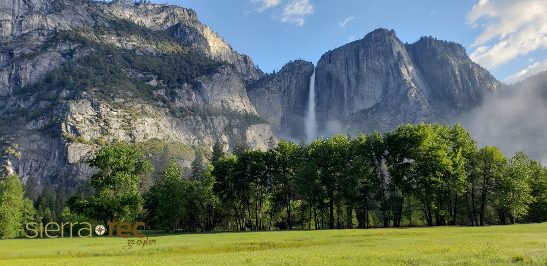
Yosemite National Park announces Yosemite Valley, Wawona Road, the Mariposa Grove of Giant Sequoias, the Merced Grove of Giant Sequoias, Hetch Hetchy, and other areas will remain closed to all visitors through Sunday, August 5, 2018, due to continued unhealthy smoke impacts and ongoing firefighting operations. For information on Yosemite National Park, go to: nps.gov/yose or call 209-372-0200. Road Closure map and
The public is reminded to stay vigilant on current fire conditions.

FOREST SERVICE CLOSURE ORDERS: The purpose of these closure orders is to provide safety to the public and for the firefighters who are engaged in fire suppression and rehabilitation efforts within the Ferguson Fire Closure Area
Sierra National Forest and Stanislaus National Forest
MANDATORY EVACUATIONS: Areas that are currently under a mandatory evacuation include:
Anderson Valley
River Road from Briceburg to last BLM Campground
El Portal Trailer Court
Foresta
Old El Portal
Old Yosemite Road
Yosemite View Lodge
Yosemite West
ADVISORY EVACUATIONS:
Cedar Lodge/Indian Flat Campground
Rancheria Flat and all campgrounds along Highway 140
Savages’Trading Post
ROAD CLOSURES:
Highway 120 is closed between Crane Flat and Big Oak Flat entrance
Anderson Valley Road
Foresta Road
River Road from Briceburg to the gate at Railroad Flat and all campground areas along 140
Summit Road
Old Yosemite Road
Wawona Road (Highway 41) between Chilnualna Falls in Wawona and Bridalveil Road in Yosemite Valley
Incline Road and Highway 140 from the entrance to Yosemite National Park to 1.5 miles east of Midpines are closed to everyone except residents.
Forest Order 16-2018-7 identifies an area of Groveland Ranger District from Ferguson Ridge in the south to Pilot Ridge in the north that is closed to public access.
Basic Information
| Current as of | 8/2/2018, 5:59:30 AM |
| Incident Type | Wildfire |
| Cause | Unknown |
| Date of Origin | Friday, July 13th, 2018 approx. 08:30 PM |
| Location | Highway 140 and Savages Trading Post |
| Incident Commander | Jay Kurth, California Interagency Incident Management Team 4(CIIMT4) |
| Incident Description | . |
| Coordinates | 37.652 latitude, -119.881 longitude |
Current Situation
| Total Personnel | 3,344 |
| Size | 68,610 Acres |
| Percent of Perimeter Contained | 39% |
| Fuels Involved | Brush and timber, burning in steep inaccessible terrain. |
| Significant Events | Hwy 140 is closed from 1.9 miles east of Midpines to the Cedar Lodge area MOTORISTS ARE ADVISED TO USE AN ALTERNATE ROUTE |
Main Page Photo Credit: Team Rubicon